The Pukerua Bay Village Plan is also available as a PDF (1.4MB).
This is the second village plan developed for and by the Pukerua Bay community, with the first published in 2007.
Pukerua Bay Village Plan 2011
A plan for our place, our people
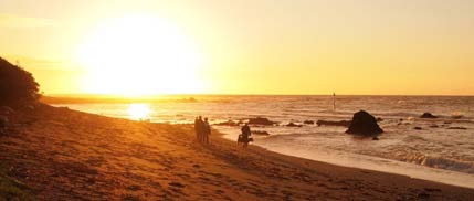
Shore south of Pukerua Bay.
The plans form part of Porirua City’s Village Planning framework, created to give communities greater say in shaping their neighbourhoods. The constructive relationship that this has fostered between the community and Porirua City Council is deeply valued by residents.
This plan is the result of a collaborative process. The community participated in an extensive survey in 2010, with more than 20% of households (and community groups) participating. Responses to the survey were analysed and presented at the well-attended 2010 Residents’ Association AGM. There, many residents took the opportunity to provide further feedback.
The Village Plan 2011 sets the direction for the Residents’ Association’s work over the next three to four years. Its implementation is a joint responsibility, shared by Porirua City Council, the Residents’ Association Committee, and by the wider Pukerua Bay community (all of whom are members of the Residents’ Association).
We now have a rich source of information – and inspiration – to inform detailed planning. Our Village Plan is intended to be a living document, responsive to the wishes and interests of the Pukerua Bay community.
Our thanks to all who participated in the 2010 survey – this is your plan.
Pukerua Bay Residents’ Association, Pukerua Bay Village Planning Team: Robyn Moore, Kate Dreaver, Dagmar Pesendorfer.
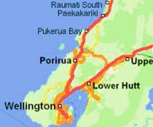
About Pukerua Bay
Kapiti Island from Pukerua Bay (image by R. Moore).
Pukerua Bay is a seaside village nestled in farmland at the northernmost end of Porirua City. Its earliest settlers are believed to have been Ngati Iri, and later, Muaupoko and Ngati Toa. The first pakeha settlers were farmers and railway workers. Later, Pukerua Bay became a seaside resort, and still later, a suburb of Porirua.
Pukerua Bay has long been a place of transit. In pre-European times, it was a key route for travellers going north or south. In 1866, the railway opened and was a catalyst for pakeha settlement. Road access to Plimmerton was established in 1928. Work began on the current highway in 1936 and in 1939, the Centennial Highway between Pukerua Bay and Paekakariki was opened.
Road and rail have promoted growth and also been a source of controversy. Our community has watched with real and growing concern as the build-up of traffic on the highway creates serious safety and severance issues that remain unaddressed by successive governing bodies. In 2011, the community’s frustration was compounded by the Greater Wellington Regional Council’s decision to close Muri Railway Station, on advice from KiwiRail.
In 2006, 1722 people lived permanently in Pukerua Bay, in 630 dwellings. With the St. Mary’s development off Gray Street, dwellings number more than 660 in 2011. A higher than average proportion of the Bay’s population live in one-family households with children. Residents’ income and education levels tend to be higher than average compared to others in the Wellington region. We also know that residents greatly value the environment and that this is expressed in their use of public transport. A 2009 survey found that 18.7 per cent of residents used public transport to get to work, compared to 13.4 per cent in Wellington and 11.4 per cent in Porirua. See Pukerua Bay’s Neighbourhood Accessibility Plan (NAP) (791kB PDF).
Priorities
Residents of Pukerua Bay place the highest value on the following four qualities:
Protecting our beach and marine environment
Making Pukerua Bay a safe place to walk and cycle
Dependable public transport
A natural environment
Action: These priorities will be reflected in the work of the Association, including in our advocacy work.
Water-cave by Wairaka Rock, which according to Māori legend is the petrified wife of the explorer Haunui (image by R. Moore).
Vision
Vision 2007: Community of choice for residents and families seeking a friendly, small village in a peaceful, unspoiled natural setting, supported by good local infrastructure and facilities.
Many of our survey participants told us that “unspoiled” is a contradiction, as we live in a developed environment. Moreover, if we add “caring”, we encompass a care element that would not exclude care and protection for the environment, while also reflecting the commonly noted theme of safety. We were also reminded about this community’s creative spirit, nurturing artists of all kinds, from poets to potters, singers to film makers.
Vision 2011
The people of Pukerua Bay foster a friendly, caring, village environment in a peaceful, natural setting, supported by effective infrastructure and facilities, and nurturing creativity.
Action: The actions outlined in the rest of this plan are intended to achieve this vision and to be consistent with the community’s priorities.
Community Facilities
2.1 Web Site
The survey results suggested the need to raise residents’ awareness of the web site. There was a generally positive response from those familiar with the site, with a range of suggested improvements.
Action: Organise a group to further develop the site, with improvements including:
Making it more interactive, inviting contributions from the community
Updating the site more frequently (e.g. on the status of marine protection measures and research)
Connecting to the gold/green/blue trails
Adding more links to community groups, facilities, etc.
Adding more photos of people in action
2.2 Pukerua Bay School and Community Hall
The School and Community Hall was built in 1973, after lengthy fundraising by the local community. While in recent years, financial and insurance issues meant that ownership passed to the Ministry of Education, it is still managed in partnership with the community and may be used as a welfare centre in a Civil Defence emergency. The hall is available for hire, and important community events are held there. A significant number of survey respondents were happy to see village planning money contribute to enhancing this amenity alongside contributions from the MoE, which has shared responsibility.
Action: Support the School’s Board of Trustees and hall committee to advance the following:
Refurbishment of the kitchen and bathrooms
Upgrading/servicing the audiovisual equipment
Improved heating/insulation
Brightening the interior
Some people also expressed concern about the deteriorating state of the Scout Hall in Kotipu Place.
Action: Keep a watching brief.
2.3 Early Childhood Facilities and Well-Child Services
Residents are happy with the quality of early childhood services in Pukerua Bay, but concerned about their accessibility for local children. At the time of writing this Plan, there is a proposal from the Wellington Regional Kindergarten Association (WRKA) to extend the pre-school. This would increase the number of places available and WRKA has indicated that it will run a managed enrolment policy that would prioritise local children. There are issues to work through, including studying the potential impact of increased vehicle movements, and carefully considering the combined effects on neighbours and on the adjacent Wairaka Reserve.
Action: Facilitate communication about the proposed expansion and contribute to a negotiated solution.
2.4 Other Community Facilities
Library
Residents value the library. They feel that some of our existing facilities (e.g. the churches, RSA, and scout hall) could be used more effectively. A number of people see a need for a cafe.
…a café, wine bar – with regular live music 🙂
…a seasonal coffee cart would be great … Park it at the station/by St. Mark’s Church for parents after dropping off kids or Saturdays/Sundays for the crowd that plays soccer at the school/near the shops/at the beach/by the library
…create some solid opportunities to meet other residents and improve the area … e.g. beach clean-up and BBQ or tree planting sessions
…St. Mary’s have a few get-togethers on the reserve … creates great atmosphere.
Action: None at present, but maintain a watching brief.
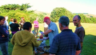
Greenmeadows Park – Neighbour’s party 2011.
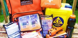
Civil Defence/Neighbourhood Support
It was suggested that Civil Defence and readiness need more prominence, aligning some activities with Neighbourhood Watch/Support, as suitable.
Action: Civil Defence actions as suggested above. Work with the school and other groups to advance community participation and readiness.
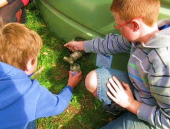
Year 7/8 children taking water samples from the emergency water tank at Pukerua Bay School.
Toilets
Toilet block – Pukerua Bay beach (Planting day, Spring 2011).
Some respondents would like to see public toilets near the skate park and railway station for the use of people who skate, use the train, cycle the Ara Harakeke path, take walks through the Secret Valley, and use the children’s playground.
The toilet buildings on the beach look like they “grew” out of the ground, which was the adopted design brief … vandals are known to target “ugly” structures much more than those with some aesthetic beauty.
Action: Consider the feasibility of toilet facilities near the skate park/railway station.
Recreational Facilities
3.1 Skate Park
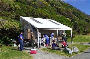
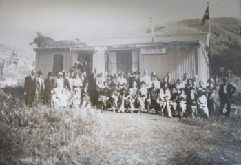
Pukerua Bay Golf Club – see the historic photos in the Pukerua Bay library.
The skate park was a major initiative of the 2007 Village Plan. Local teenagers, parents and other skaters collaborated with Porirua City Council and the Residents’ Association, appointing a designer who worked closely with the local skaters to create a first-rate and well-used amenity. The park is strongly supported by the community, despite concerns being raised about graffiti and the dynamics of different groups of users. There was a mixed response to a question on lighting, with a trend towards not having floodlights. Thank you PCC for funding and facilitating this through Village Planning.
Skateboard facility is pretty flash – well done to the development committee…
…it’s something for Pukerua Bay to be proud of…
…the skate park is an asset, but graffiti management is an issue…
Action:
Work with PCC to address graffiti and other concerns, in line with council policy – immediate “knock-down” of graffiti, increased surveillance, police visits, adult/peer supervision
Explore use of cameras, trimming vegetation, appropriate security lighting
Consider enhancements such as seating and toilet facilities
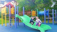
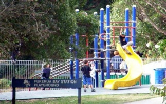
3.2 Playgrounds and Playing Fields
Under 6’s playground next to skate park.
Our playgrounds and playing fields supplement the natural playground created by the beach, reserves, and surrounding farmland. There is some support for a playground at St. Mary’s Estate and strong support for ensuring that the current playgrounds and playing fields are properly cared for. Some residents would like us to expand the experiences they offer, with particular mention made of Greenmeadows Park in Kotipu Place.
Action – Protect and enhance our playgrounds and playing fields:
Work with PCC and the community to explore opportunities for improving recreational facilities
Upgrade Greenmeadows playground to cater for substantial use during soccer games and practices
Provide more adventure style/creative design and facilities (a flying fox was suggested for Greenmeadows)
Keep cars off Greenmeadows and Wairaka Road play area
Improve drainage at Greenmeadows
Provide more seating at playgrounds (keep natural)
Fence the Pukerua Bay Station playground
Trim vegetation at the Wairaka Road and Muri playgrounds to reduce shade
The playground at Greenmeadows gets use when there are soccer games, events at Scout hall, etc.
…the play area could easily be expanded to provide more variety … Greenmeadows has heaps of space for a slide, etc. …a flying fox
3.3 Boat ramp
The boat ramp on Ocean Parade is an important asset for residents of a seaside community. While it is clear that it requires maintenance for the benefit of local users, it is equally clear that residents do not wish it to be enlarged or upgraded in ways that increase its use and add to parking and safety issues at the beach.
Action: Do appropriate restoration work on the boat ramp in collaboration with beach residents and local boaties.
Physical environment
4.1 Green (ecological) and Gold (historical) Trails
There is strong community support for the development of Green and Gold Trails that will highlight significant historical and ecological sites in Pukerua Bay. There is also some support for Blue (coastal and streambed) Trails. The Gold Trail will follow a route that will commence at the Taupo Swamp and continue north of Pukerua Bay, finishing close to the northern limits of the city council boundary. The Green Trail will take users from land and stream to sea. A key feature will be a pou whenua that will stand at the beach. This long-term project has recently been reactivated.
Action – The trails sub-committee will:
Develop an agreed project plan, and endeavour to ramp up implementation.
Enact the project in collaboration with PCC, local experts and tangata whenua
Ensure that this project is integrated into our work on marine protection and on protecting and enhancing the beach front and other significant ecological sites
Use digital technology such as GPS/GIS to enable a range of “entries” into the trails
Ensure that the trails tell the stories of Pukerua Bay in ways that are informative and appealing to visitors and residents
Green and gold trails – yes please!
Linked to detailed information on the web site.
…need better signage to all the reserves/walkways
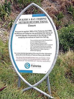
4.2 Marine Protection Measures
Pukerua Bay beach (image by R. Moore).
The beach and marine environment are deeply valued by residents and Ngati Toa. We acknowledge our shared responsibility to protect them.
Action – The marine protection sub-committee will:
Work with Ngati Toa and the relevant authorities to ensure that the most appropriate beach and marine protection measures extend beyond 2014, when current (MoF) protection expires
Ensure adequate policing of the marine protection measures
Promote effective signage – marine protection info with hotline number prominent (0800 4 POACHER), biodiversity information and dog-control advice/regulations
Marine protection is working well and should be enshrined…
…keep for as long as it takes for the ecology to be restored…
…had noticed the paua population dropping away and now seems to be increasing. The measures must be maintained…
…anything that helps protect the marine environment is to be supported wholly.
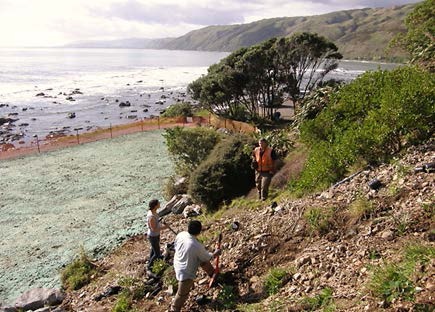
Residents strongly value the environment and want landscaping work to be consistent with the “natural feel” of the landscaping carried out at Ocean Parade in 2010 (creating natural landscape from what was once a concreted car park) and the hugely popular Goat Track.
Many residents are keen to participate in protecting and enhancing the environment, as demonstrated by their enthusiastic participation in community working bees. There are strong concerns about current indiscriminate weed control practices.
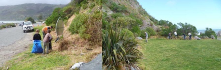
Turning concrete into paradise – 70 volunteers planted 1500 shrubs with PCC staff.
Overall, public areas of Pukerua Bay are quite scruffy, needing regular care and weed control
…Spraying along the track to the beach is not helpful to erosion or to native plants…
…keep up the community planting/clearing days.
Action:
Spruce up the shop area and the planted area by Muri Station
Upgrade State Highway 1 footpaths
Continue with the beachfront landscaping
Improve liaison between locals, PCC, GWRC and other relevant authorities in order to:
Address erosion, particularly on the paths to the beach, caused by current weed control practices
Combat invasive weeds (especially on path along the beach)
Enable better coordination between PCC and locals to maintain landscaped areas
Ensure that weed control practices do not harm valued vegetation that is indigenous/protective
Ensure that vegetation does not block street signs, intrude on footpaths, or obstruct street lighting
Provide opportunities for people to be involved in environmental work by supporting the work of Nga Uruora, the Waimapihi Care Group and Keep Pukerua Bay Beautiful
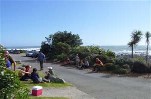
Community planting and BBQ – Spring 2011 (image by R. Moore).
Conserve, restore, protect. Deal to weeds. Use local seed sourced natives, create habitat for gecko, skinks and weta.
…Raroa Reserve needs some attention … and better signage
Continue with community planting days (our BBQs are a popular motivation) and use this engagement and other measures to educate residents about preventing noxious weeds spreading from their gardens. Also:
Provide containers/pickup points for people to put weeds they have pulled out along the beach track
Set up an “adopt a spot” for weeding and landscaping
4.4 Muri Reserve
Muri Reserve is a peaceful spot that lies between Sea Vista Drive and Muri Station. The current developed area is on flat land surrounded by planting, with views of the hills and sea. It is a popular walking route and dog exercise area, though it does not currently have much of a path. Access to Sea Vista Drive is on a steep incline and patches become boggy in wet weather. Next to the developed area is a wetland where frogs and copper butterflies have been noted. There is historical evidence of kumara pits.
Action:
Maintain current flat area as is and consider its use for summer cushion concerts
Construct a carefully designed pathway on the perimeter (so it does not intrude on people’s activities)
Consider multiple purposes for the undeveloped area, taking into account the following considerations:
Connective walkways from Muri Station and Muri Road to Sea Vista Drive are essential
Protecting ecological (e.g. wetland) and historical values is a priority
There was some support for developing a BMX or mountain bike track in Pukerua Bay, but slightly more people strongly disagreed with the idea in that location – though some liked the idea of a small bike trail in the reserve, for pre-teens.
There was strong support for a community garden and/or orchard, though many people noted that provision for this should not exclude other ways to enjoy the reserve, including support for:
Other planting – primarily native
Recreational activities – suggestions include goal posts, netball/basketball hoops, giant chess board, BMX style track for pre-teens or pre-schoolers, a picnic area, a gas (public) BBQ
Continue use as a dog exercise area
A summer festival would be perfect in that space … outdoor daytime music concerts showcasing local talent, apply for grants to draw in some outside musicians … offer a cafe as fundraiser…
4.5 Vandalism
Vandalism and graffiti are a concern for some residents. In general, people favour deterrence measures, such as greater surveillance and the fostering of pride in “our place”. They want parents to be involved in dealing with culprits, and tend to favour a restorative justice approach to punishment.
Action:
Be more proactive about implementing PCC’s vandalism/graffiti policy
Design seating and other structures in ways that discourage vandalism/graffiti (successful examples are the toilets on Ocean Parade)
4.6 Drainage
Residents are concerned about flooding caused by blocked drains.
Action:
Educate residents that vegetation and objects swept into gutters contribute to overflowing drains later
Encourage more leak detection – some flooding is caused by already saturated ground being unable to cope with extreme rain events
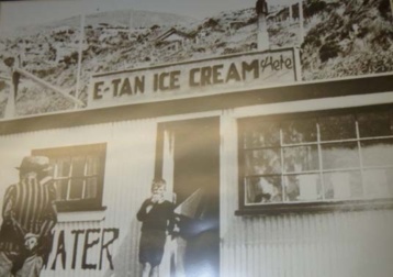
Ice cream shop at the beach – see the historic photos in the Pukerua Bay library.
4.7 Advocacy regarding sustainability
Residents greatly value Pukerua Bay’s natural environment and its sense of community. They support contained growth that is consistent with our shared ecological and social values.
Action: Maintain the current message about sustainable growth in all submissions and enact this principle in all our actions.
Movement in and around the Bay
5.1 Walkways/Footpaths
There are three factors to consider in developing walkways around Pukerua Bay:
Addressing the safety and severance issues for people moving in and around Pukerua Bay, using the Neighbourhood Accessibility Plan as a key document, while taking into account changes in circumstances (such as the closure of Muri Station) and new opportunities (such as new road safety technology)
The need for better maintenance of our current walkways and the message from residents that they like the natural style of the re-developed Goat Track
Residents’ enjoyment of the environment and their enthusiasm for having walkways that enable them to explore the local environment and connect to Plimmerton and Paekakariki
Action:
Extend the current Ara Harakeke cycle/walk way north to Waimarino Road – there was near unanimous support for this project
Investigate feasibility of constructing a walkway from St. Mary’s Estate to Muri Road
Address maintenance issues (e.g. drainage, erosion, subsidence, weed control) in the following areas:
The area under the pedestrian bridge by Te Kura Road
Western side of SH1 footpath from the shops to Wairaka Road
Eastern side of SH1 footpath from the end of Muri Road to Teihana Road
Erosion and drainage on current paths down to the beach
The Secret Valley (Waimapihi Stream)
Consider the following projects:
Upgrade the informal track from Pa Road to the beach
With agreement of farmers, establish walkways on farmland
Engage with the Coats family on the proposed walkway through their family’s land to the beach
Explore potential for a walkway from Wairaka Reserve to the beach
Establish a mountain bike track around beach or over hills to Plimmerton
Seating for the Goat Track
Walkways linking Pukerua Bay with Paekakariki, Plimmerton – but note comments that if resources are scarce, they should be prioritised on spending within Pukerua Bay
Spruce up the shop area – replanting, re-grading surfaces, as was done in Plimmerton
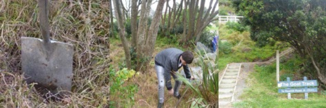
The Goat Track refurbishment is superb! Not over the top or obtrusive … just fabulous, all ages love it!
Continue with “Goat Track”-style improvements
Let’s link with Paekakariki via the hilltops (Te Araroa walkway)
Things I really appreciate about Pukerua Bay:
Beach access and the walk south along the escarpment, native plants, gecko, skink, Ara Harakeke pathway and other paths, random community sculptures and space, no powerlines, the little tracks through the valley (Waimapihi “Secret” Valley) en route to Pukerua Bay Station … anything to enhance the above is gratefully received.
Transport and Roading
Site for a safe crossing – Teihana Road/SH1 intersection.
Pukerua Bay is cut in two by State Highway 1. Successive governments and roading administrations have consulted with residents about the safety and severance issues that this causes and much money has been spent on surveys and reports. In the meantime, the volume of traffic on the road increases year by year. Unsurprisingly, residents are deeply concerned about safety on the road and footpaths, with particular concerns expressed about:
The need for a safe crossing over SH1 at the shops (despite earlier favouring an underpass, the comments in the Village Plan survey indicate a trend towards acceptance of a pedestrian bridge as an alternative safe crossing)
The difficulty of getting in and out of intersections (especially at Pukerua Beach Road and Gray Street)
Unreliable public transport – a big problem for commuters and non-drivers
Action:
Continue to work towards the integrated and coherent set of solutions proposed in the Neighbourhood Accessibility Plan, taking the recent closure of Muri Station into consideration. In addition:
Investigate installing speed bumps or similar speed-reducing mechanisms (and lighting improvements) on Muri Road and possibly Pukerua Beach Road
Investigate the potential for a slipway for traffic turning left from Gray Street heading south down highway
Support recent neighbourhood action to keep berms mowed (Muri Road)
Install effective signage such as the red zigzags and “Merge like a zip” (seen at Paekakariki)
Shift the 50km/h signs further out
Investigate support for a proposal to prohibit right turns into Wairaka Road from the north
Better communicate with our community why traffic lights/pedestrian islands are not a favoured approach to crossing at the Teihana Road shops intersection (among the constraints are road size and gradient)
It is very frustrating not being able to (safely) cross the State Highway from the “upper” east side…
…need a safe crossing! – by the dairy
Access via a well-lit crossing is required near Archway Books…
We’ve been here 40 years and this problem of access to the main road is far worse than earlier – would be good to see some improvements
SH1 traffic is nearly always travelling over the speed limit…
…It is very stressful crossing (at Teihana Road) – going all the way down to the bridge (by Wairaka Road) and back just doesn’t seem practical
Put up signs … Please leave gaps for entering traffic/Merge like a zip
Keep the speed-control “camera” (by the shops)
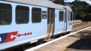
KiwiRail cited ‘step distance’ as the key reason for closing Muri Station.
Muri Station
The closure of Muri Station in April 2011 was a blow for our community, adding to the dangers and difficulties for people moving in and around the Bay. There are especially negative impacts on residents in the northern part of the Bay. As a community “grown-up” around rail, there is sense of betrayal and frustration over this decision. The closure clashes with our preference for public transport and we’re told by survey respondents, it is likely to result in more people using their cars to get to activities outside of the Bay. In addition, investment will be needed to improve pedestrian safety for the extended walk/cycle to Pukerua Bay Station (Muri Road for example).
…We use Muri Station every day for school and work. It will increase walking time by ten minutes each way…
We must keep Muri Station open – for those without cars, to keep more cars off the road, to plan for population increases
…It is a character little country station too … if it closes I will be disappointed – and a bit sad
We like the station upgrade … but, need more weather protection at Pukerua Bay Station – could the Muri Station shelter be moved?
GWRC received nearly 70 submissions on the station closure.
Action:
Work with NZTA, PCC, and GWRC to improve pedestrian safety between northern Pukerua Bay and Pukerua Bay Station
Continue to pursue re-instatement of train services at Muri Station
Acknowledgements
Our wholehearted thanks go to Villages coordinator Ian Barlow for his contribution to the Village Planning process and to our mayor, councillors and officials, for their valued support.
A Village Plan is nothing without support from the village itself – our awesome Pukerua Bay community – thank you.
And not least, thank you to the people who helped in the task of designing and conducting the 2010 survey, using the analysis of information and observations from nearly 130 households to prepare this Village Plan 2011. The Village Planning project team gratefully acknowledges Pat Hanley, Julie Warren and Julie’s assistant Sam, for their input.
We absolutely love living here. The community is warm and welcoming and the setting is gorgeous…
We love Pukerua Bay … so far it has exceeded our expectations
…a great community with good local support, a great school, pre-school and kindy
…one priority should be enabling older people to continue living here
…lots of good amenities, churches, tennis courts, skate park, parks and children’s playing areas
 In 2006, 1722 people lived permanently in Pukerua Bay, in 630 dwellings. With the St. Mary’s development off Gray Street, dwellings number more than 660 in 2011. A higher than average proportion of the Bay’s population live in one-family households with children. Residents’ income and education levels tend to be higher than average compared to others in the Wellington region. We also know that residents greatly value the environment and that this is expressed in their use of public transport. A 2009 survey found that 18.7 per cent of residents used public transport to get to work, compared to 13.4 per cent in Wellington and 11.4 per cent in Porirua. See Pukerua Bay’s Neighbourhood Accessibility Plan (NAP) (791kB PDF).
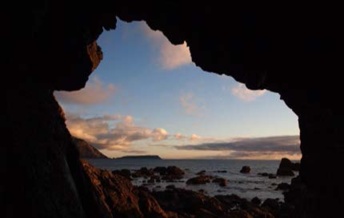
