Skip to content
Pukerua Bay, New Zealand
  • Home
  • About
    • History
    • Map
    • Local Artists
    • Recreation
    • Business Directory
  • Kōrero Newsletter
    • COVID Courier
  • Village Planning
  • Groups
    • Community Garden
    • He Ara Pukerua
    • Waste Free Pukerua Bay
  • Climate change
  • Residents’ Association
    • Minutes
    • Annual Reports
    • Resources
    • COVID-19
    • Login
  • Contact Us

Map

PukeruaBayMap
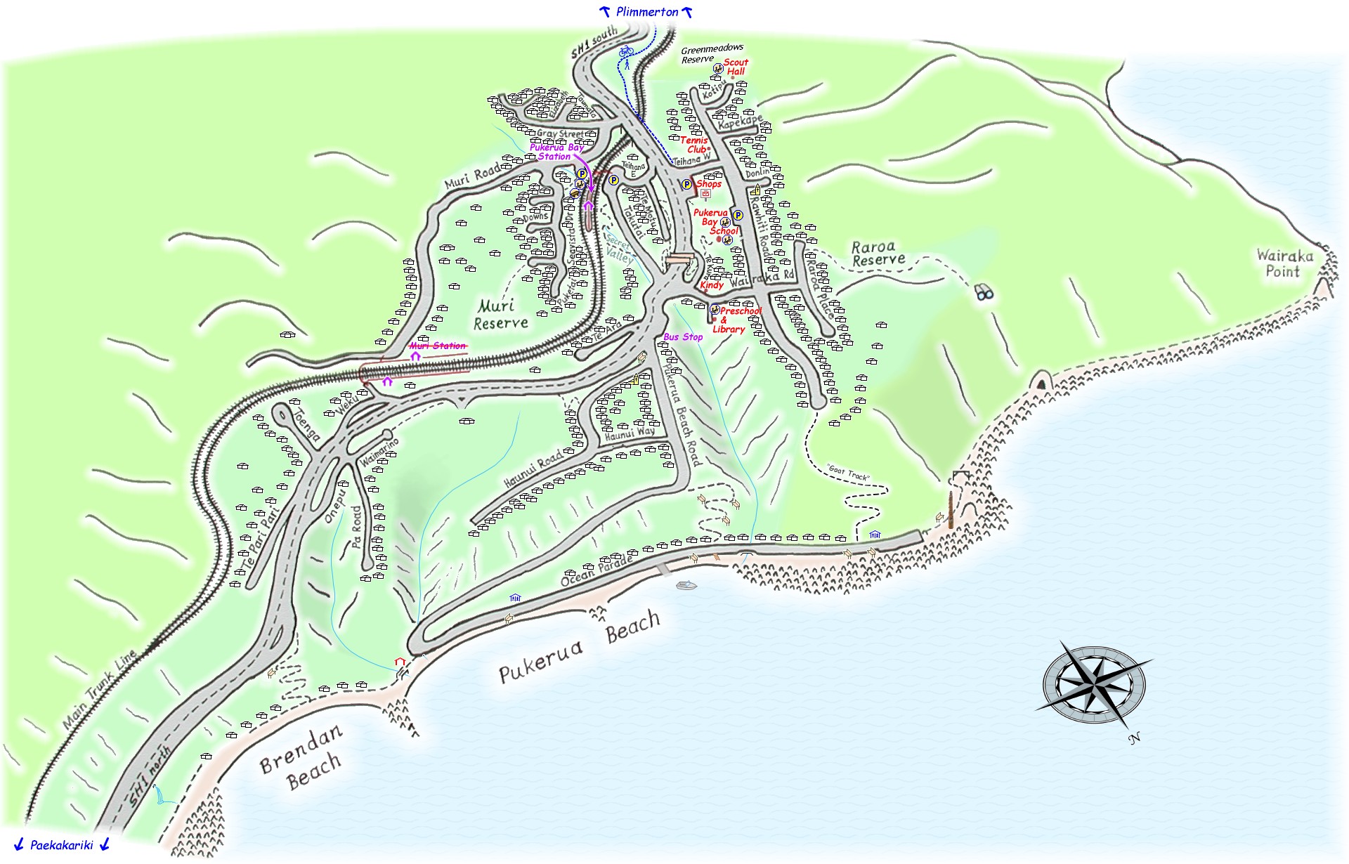
The map of Pukerua Bay and amenities contains amenities such as car parks, playgrounds, public toilets, location of NZ Post mailboxes, walkways, etc.

You can also find Pukerua Bay on Google Maps, OpenStreetMap and Google Earth (requires the Google Earth app).

Share this:

  • Click to share on Twitter (Opens in new window)
  • Click to share on Facebook (Opens in new window)
  • Click to share on Reddit (Opens in new window)
  • Click to share on Telegram (Opens in new window)

Like this:

Like Loading...

Connect with Us

Neighbourly   Facebook

Monthly Meetings

Meetings are held on the second Tuesday of the month (except January), at:
Pukerua Bay RSA, 5 Wairaka Road, Pukerua Bay.
secretary@pukeruabay.org.nz

Useful Links

  • Pukerua Bay Hub
  • Pukerua Bay School
  • He Ara Pukerua
  • Waste Free Pukerua Bay
  • Porirua City Council
  • Get the Antenno app (Android, Apple)
  • Neighbourhood Support

Topics

Archives

Copyright © 2025 Pukerua Bay, New Zealand | Powered by Astra WordPress Theme
 

Loading Comments...
 

    %d